South Platte River
Metro employees have been monitoring upstream and downstream water quality and biological conditions along the South Platte River for over 50 years.
This monitoring over the years has included habitat, fish, macroinvertebrates, reservoirs, groundwater, and many special studies. Metro has been a leader in the environmental field by providing sound data to support regulatory policies and plant upgrades.

The South Platte River through Denver is one of the most monitored rivers in the state.
Segment 15 is 26 miles long from the Burlington Ditch diversion to Big Dry Creek. For the majority of the year, the Burlington Ditch diverts the upstream South Platte River flow coming from downtown Denver, resulting in extreme low-flow conditions in the reach between the ditch diversion and the RWHTF outfalls.
Downstream of the RWHTF outfalls, the river is effluent-dominated as it flows downstream through Segment 15, past the NTP discharge to the Big Dry Creek confluence and the start of Segment 1a. Segment 1a continues another 17 miles to the confluence with the St. Vrain River.
The South Platte River is a hard-working river that is heavily used for recreation, drinking water, and agricultural irrigation.
Major influences on the river include wastewater effluent, changing flow regimes, stormwater, urban and agricultural pressures, and a changing riparian habitat.
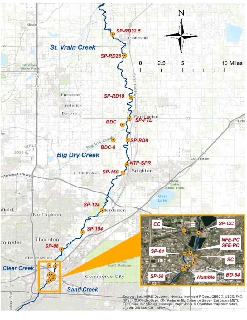
In 2023, water quality monitoring occurred at 20 permanent sampling locations from upstream of the Robert W. Hite Treatment Facility (RWHTF) to the town of Platteville. Over 50 water quality parameters are tested twice per month (bi-weekly) at these 20 monitoring sites. Additionally, biological monitoring of fish and macroinvertebrate populations were monitored at 11 locations in 2023.
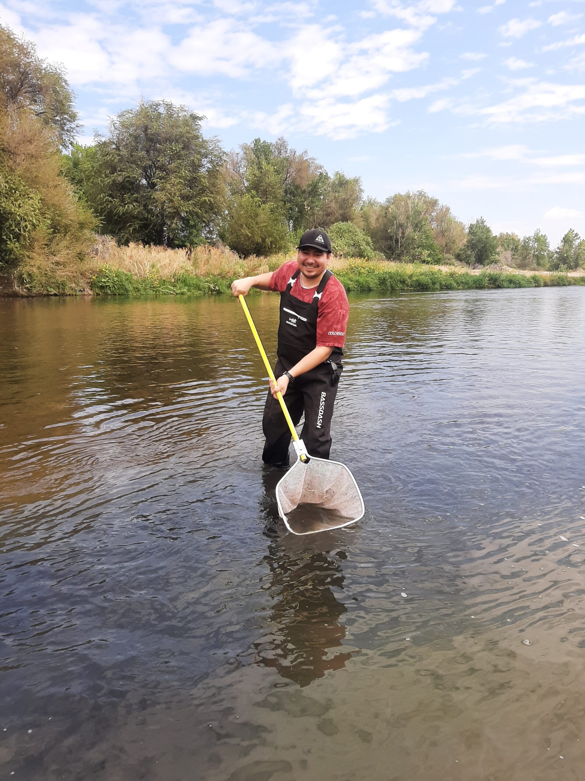
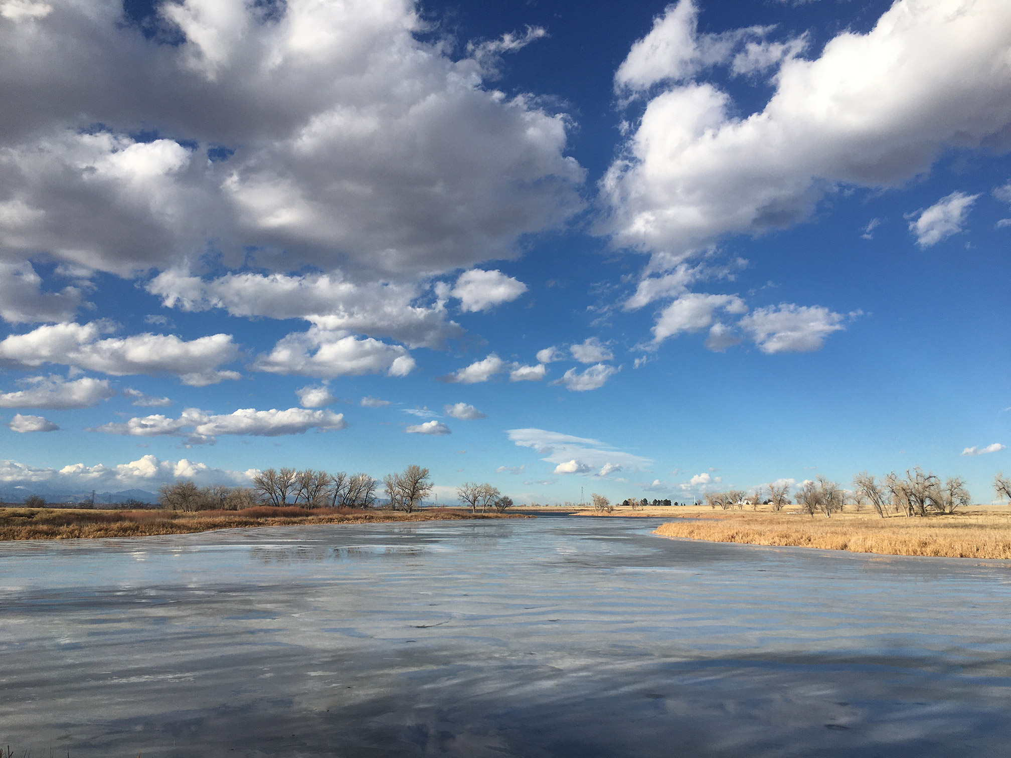
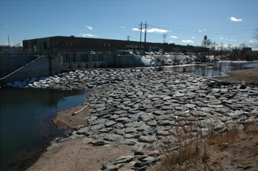
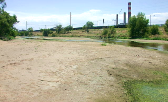
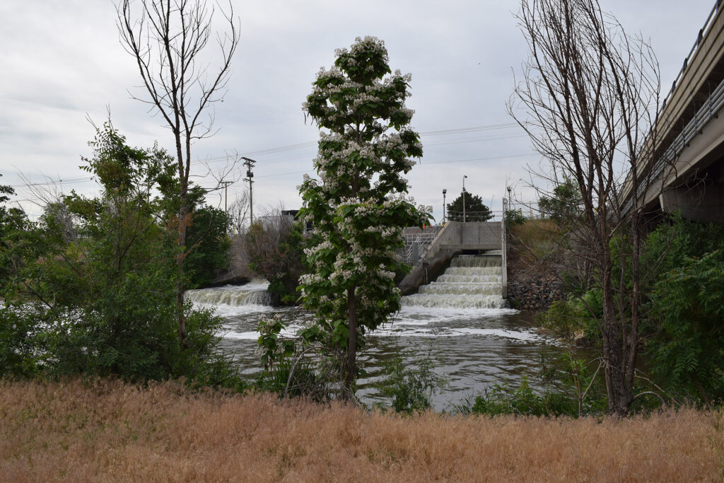
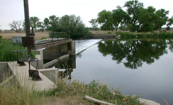
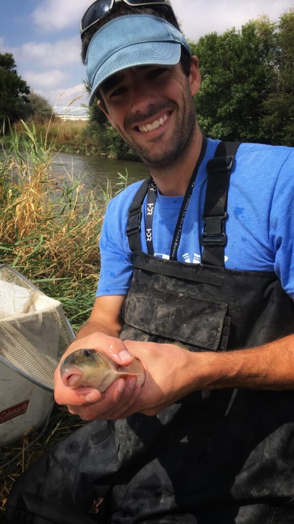
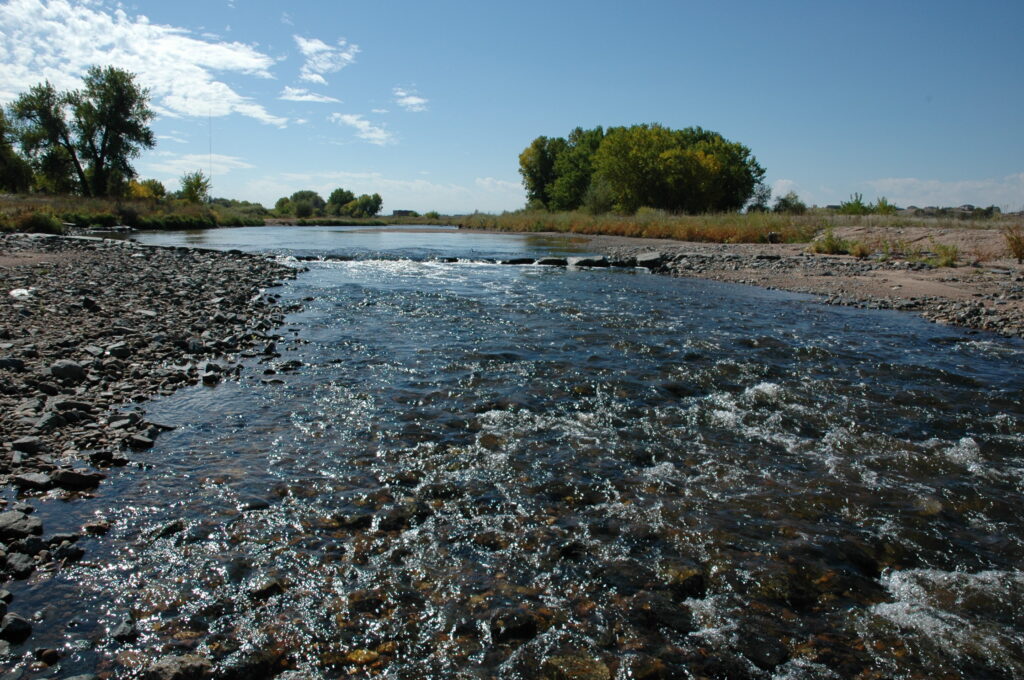
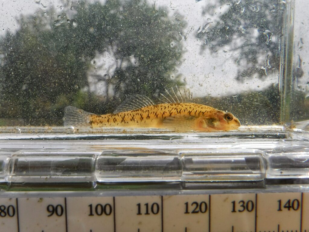
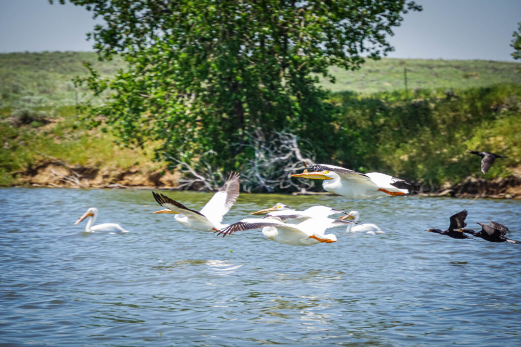
Photos of the South Platte River
Water Quality Summary of South Platte River Locations Upstream/Downstream of Metro Effluent Discharges
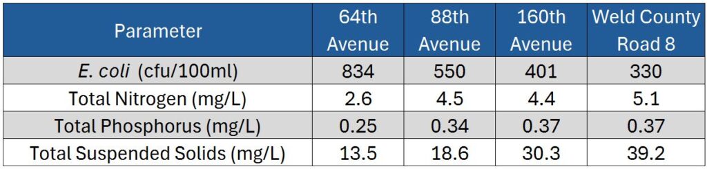
64th Avenue located ~1/4 Mile Upstream of RWHTF
88th Avenue located ~3.5 Miles Downstream of RWHTF
160th Avenue located ~1.1 Miles Upstream of NTP
Weld County Road 8 located ~4 Miles Downstream of NTP
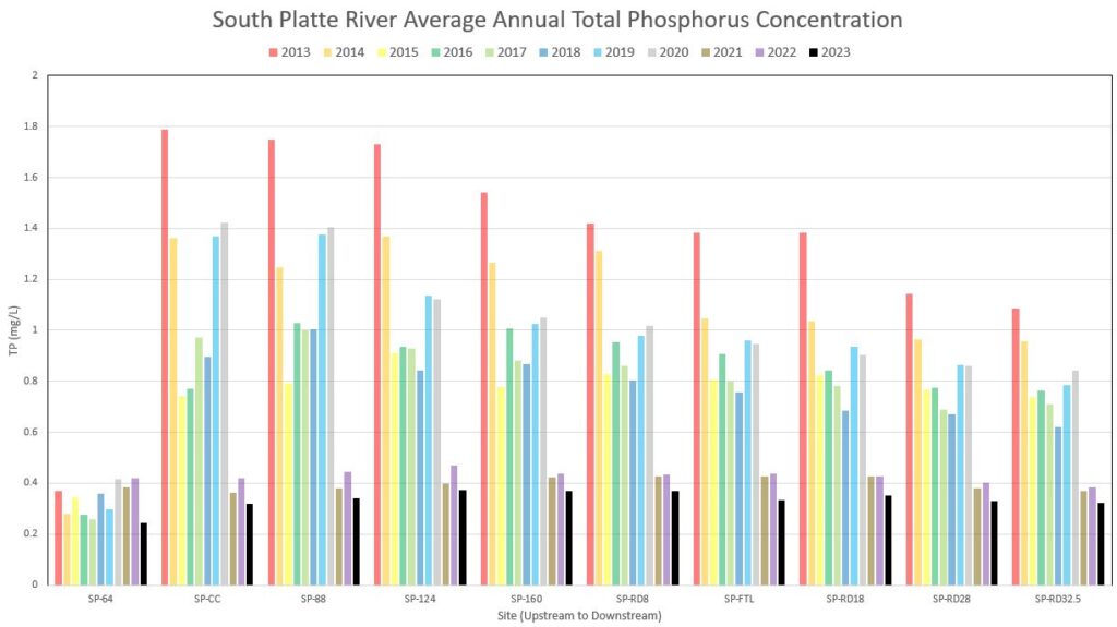
Recent Evidence of Instream Phosphorus Reductions Due to Full Scale Biological Phosphorus Removal at RWHTF
Since full scale biological phosphorus removal was implemented at the RWHTF in January 2021, Metro has documented a significant decrease in effluent and instream total phosphorus (TP) concentrations. Prior to 2021, the TP concentrations at the South Platte River monitoring locations downstream of the RWHTF discharge were drastically higher than the upstream river monitoring location at 64th Avenue. However, the 2021 annual average TP concentrations were actually lower at the closest downstream monitoring sites (SP-CC and SP-88) compared to the upstream site at 64th Avenue (SP-64). These results are encouraging and demonstrate that nutrient treatment upgrades can result in immediate and significant improvements, particularly in an effluent-dominated river such as Segment 15 of the South Platte River.
Aquatic Life Improvements Resulting from Treatment Upgrades and Instream Habitat Improvements
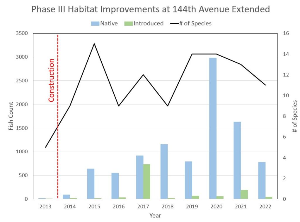
Over the past 20 years, Metro has embarked on a six-phase plan to create instream habitat improvements in Segment 15 of the South Platte River. These improvements were constructed in accordance with a 1997 Memorandum of Understanding with regulatory agencies (Environmental Protection Agency, Colorado Department of Public Health and Environment, and the Colorado Parks and Wildlife) after Metro scientists and engineers demonstrated that habitat was the most limiting factor for native fish.
In each phase, habitat improvements were designed to provide diversified habitat structures and flow characteristics preferred by native species. A team of engineers designed features like spur dikes, constructed riffles, secondary channels, vortex weirs, rock snags, boulder clusters, and more.
These habitat improvement projects have proven successful, resulting in a significant increase in both the number of fish species (species richness) and overall number of individual fish (species abundance) in the project reaches. For example, Metro staff have conducted annual fish surveys at the Phase III habitat improvement site in Brighton (144th Avenue) and documented an increase from 22 individual fish of five different species in 2013 prior to construction, to 1820 individual fish of thirteen different species in 2021 following completion of the project.
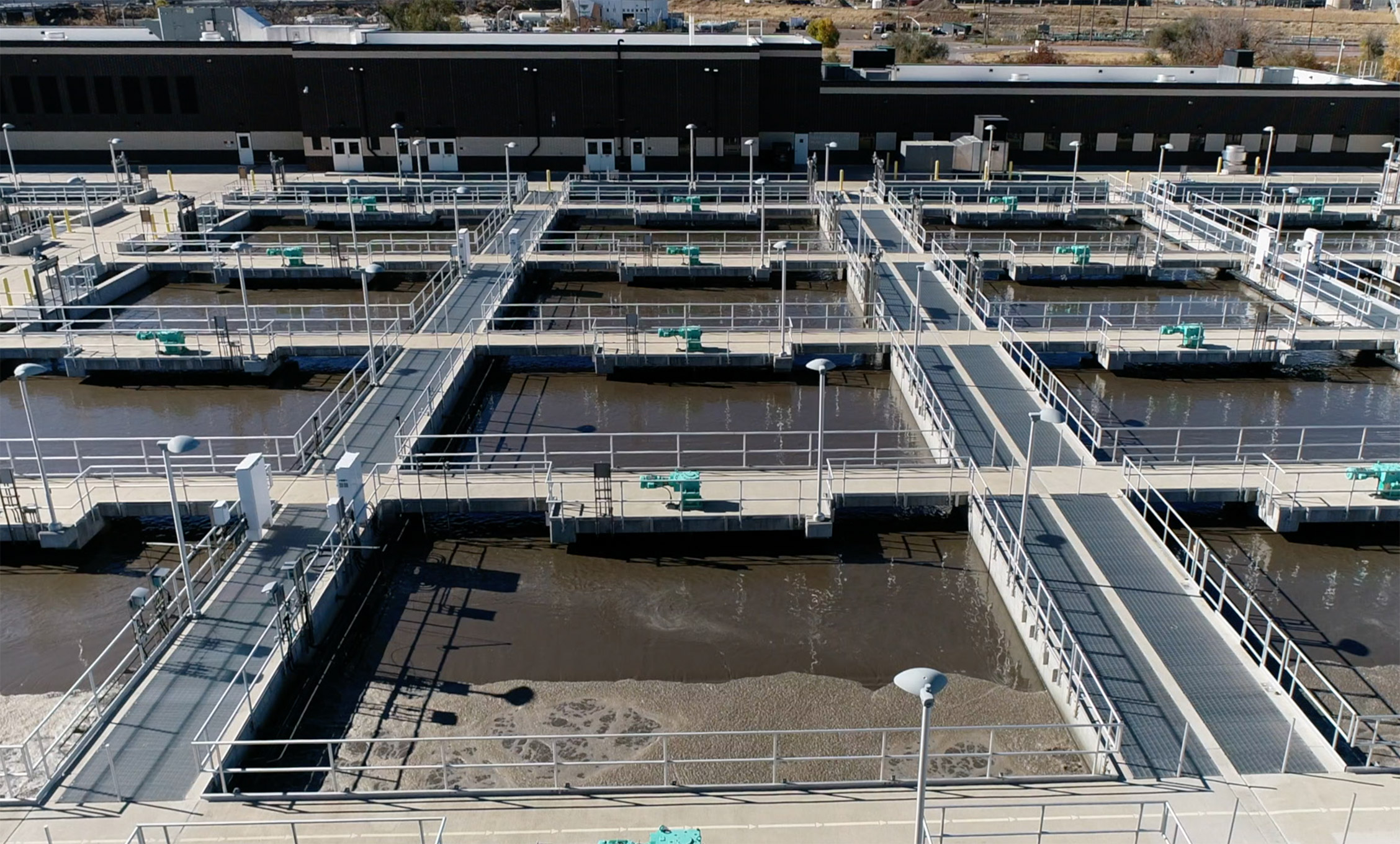
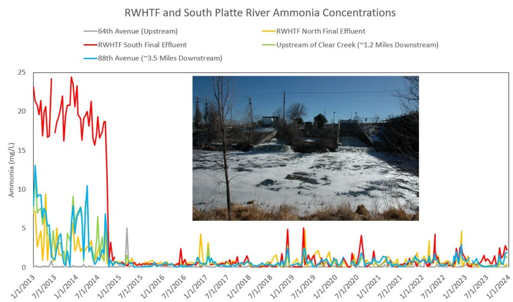
In 2014, Metro completed a $211 million project to improve performance of the RWHTF South Complex secondary treatment processes in order to meet more stringent ammonia standards.
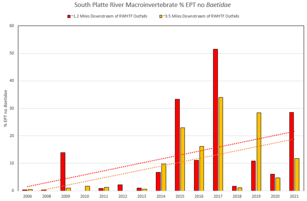
Immediately following these upgrades to improve nitrification/denitrification, the ammonia concentrations in the South Platte River downstream of the RWTHF outfalls decreased from an annual average of 4.9 mg/L in 2013 to 0.3 mg/L in 2015. Correspondingly, the macroinvertebrate community composition immediately downstream of the RWHTF outfalls shifted from being dominated by tolerant taxa (midges, aquatic worms, etc.) to a more balanced population of tolerant and sensitive taxa including mayflies and caddisflies.
In addition to this observed increase in %EPT, Metro surveys also documented a significant increase in Shannon Diversity Index values and decrease in Hilsenhoff Biotic Index values at sites downstream of the RWHTF outfalls since instream ammonia concentrations were drastically reduced in the fall of 2014.

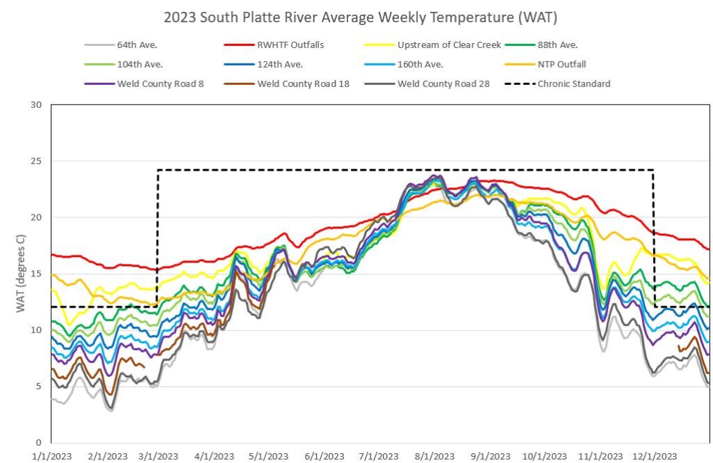
Temperature
Long-term temperature series data are routinely collected by Water Quality Division staff for the South Platte River at:
Wherever possible, the data logging thermistors are co-located with the bi-weekly stream sampling sites. This temperature information has several uses. Seasonal trends in temperature of the South Platte River below the effluent discharge, as well as the daily cycling of temperature, are important to the calculation of ammonia limits.
In 2009, the Commission adopted temperature regulations for cold and warm streams throughout the state. Long-term series data will allow Metro staff to evaluate seasonal and spatial variability of temperature in the South Platte River to evaluate the compliance status of the South Platte River below Metro’s point of discharge as judged by the applicable aquatic life temperature standards.
The 2023, temperature data demonstrate that both the North and South Final Effluents are consistently above the wintertime stream chronic (MWAT) standard. While the upstream river site (64th Avenue) was in attainment throughout the entire year, the monitoring sites immediately downstream of the RWHTF exceeded the stream standard.
For the chronic standard, there were wintertime exceedances downstream to 124th Avenue, approximately seven river miles downstream of the RWHTF outfalls. In many cases, these exceedances occurred during the abrupt change to the winter standard (December through February). While the river exhibits gradual warming and cooling, the standard itself does not reflect this seasonal pattern.
The Colorado Water Quality Control Division is in the process of revising how they assess temperature exceedances, and these proposals may provide some regulatory flexibility during the shoulder seasons. However, even with these proposed changes, the South Platte River will likely still exceed the chronic wintertime standard between the RWHTF outfalls and 88th Avenue (3.6 miles downstream).